A new Atlantic low-pressure system is bringing more rain and gales to parts of the UK as Storm Boelo moves away.
The incoming system is not currently expected to be as disruptive as Storm Boelo or Storm Austen, but warnings cover several regions and gusts could reach 85mph in the Hebrides. The forecast also shows how quickly conditions may shift from severe winds to calmer, drier weather.
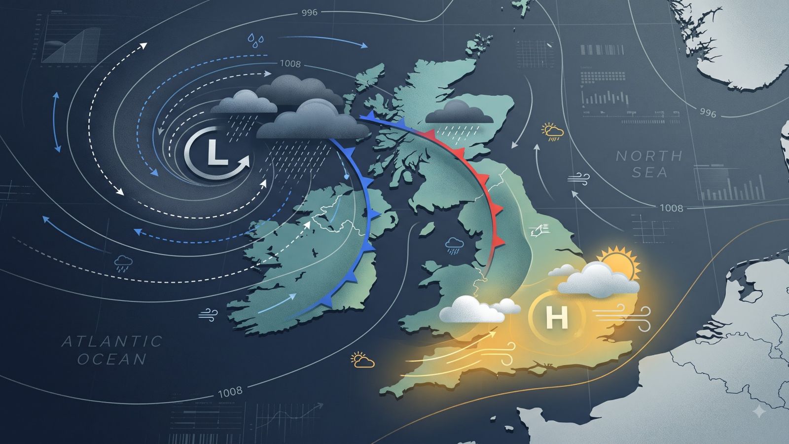
Boelo is clearing after a weekend of heavy rain and severe gales, while another deep area of low pressure is approaching from the Atlantic. The new system is expected to affect north-west parts of the UK during Monday and Tuesday.
Storm Boelo was the second named storm of the season. It brought heavy and frequent showers to northern parts of the UK, with winds expected to exceed 80mph in places over the weekend of 24-25 October 2026.
Warnings cover several regions
Yellow wind warnings are in place across western England, Wales, northern parts of Northern Ireland and much of Scotland. Separate warnings cover Northern Ireland and north-west Scotland from Monday evening until late Tuesday evening.
The incoming system has not been named. It is not currently expected to be as widely disruptive as Boelo or Austen, although the full extent of any flooding, damage or power cuts cannot yet be known.
Rain will spread quickly on Monday. It is expected to begin over south-west England, Wales and Northern Ireland before moving north-east to central, eastern and northern England and most of Scotland by around lunchtime.
Southerly winds will bring warmer air into the south, where temperatures could reach 18 or 19C. Winds will strengthen during the day, with widespread gusts of 30-40mph, around 50mph in many coastal areas and 65mph in some locations.
The low is expected to pass close to Northern Ireland and north-west Scotland overnight and on Tuesday. Winds should be at their strongest during that period, with the highest gusts possibly reaching 70-85mph in the Hebrides.
Storm Boelo and the incoming system
Storm Boelo
Named storm
80mph-plus gusts
- Westerly winds
- Affected the Central Lowlands
- Heavy rain and severe gales
Incoming system
Not named
70-85mph gusts
- South-westerly winds
- High ground may weaken winds
- Less widely disruptive forecast
A gust is a short-lived peak in wind speed, so the Hebrides figure describes the strongest bursts rather than a constant wind speed. The new system's south-westerly winds may also be weakened by high ground before reaching the biggest towns and cities.
Boelo's westerly winds were funnelled through the populated Central Lowlands, increasing the likelihood of impacts there. That differs from the expected path and direction of the new system.
What a yellow warning means
The Met Office says a yellow warning represents a low risk of significant impacts. It still means that travel, power supplies, buildings and trees could be affected.
Possible problems include travel disruption, power cuts, damage to buildings and flying debris. Some trees may also be blown over.
Further heavy rain could cause localised flooding. Large waves arriving with high tides could also lead to flooding along some coasts.
What we know
- Yellow wind warnings cover much of Scotland, northern Northern Ireland, Wales and western England.
- The strongest gusts could reach 70-85mph in the Hebrides.
- Heavy rain may cause localised flooding and coastal flooding is possible.
Still unclear
- How much flooding the incoming system will cause.
- Whether the system will later be given a name.
- The full extent of Storm Boelo's damage, power cuts and casualties.
From 9pm Saturday until 9pm Sunday, Scotland and northern England as far south as Carlisle were covered by an amber warning, the Met Office's second most severe weather warning. The warning is less severe than the alerts issued during the previous weekend's storm.
Another amber warning applied to north-east Northern Ireland from 9pm Saturday to 10am Sunday. A broad yellow warning for very wet and windy weather covered the UK's north from midday Saturday until 9pm on Sunday, while other heavy-rain warnings covered Wales and parts of western and southern England.
The earlier storm was expected to disrupt ferry and train services. TransPennine Express advised against all but essential journeys on Saturday and Sunday, while Avanti West Coast strongly advised passengers not to travel north of Preston on Sunday.
Storm Austen had already left thousands of homes without electricity in south-west England before the further weekend disruption. In that region, the National Grid said its map showed that 31,000 homes had no power at one stage on Friday and more than 3,700 still had no electricity on Saturday morning.
The weather should settle from midweek
High pressure is expected to build close to the UK from midweek. That should gradually reduce the unsettled conditions after Tuesday.
- MondayRain spreads north-east
Rain moves from south-west England, Wales and Northern Ireland across much of England and Scotland. Winds strengthen, with gusts of 30-40mph widely.
- Overnight and TuesdayWinds reach their peak
The low passes near Northern Ireland and north-west Scotland. The strongest gusts could reach 70-85mph in the Hebrides.
- Wednesday 28 OctoberConditions improve
Showers continue, but most places should be dry by the end of the day.
- ThursdayFog and mist at first
Light winds may bring mist and fog in the morning. These should mostly clear, leaving a dry day with sunny spells.
- FridayRain may return west
A weather front could bring rain back to western areas before high pressure rebuilds.
By Wednesday 28 October, showers should continue, although dry conditions are expected in most places by the day's end.
A further band of rain could reach western areas on Friday. After that, high pressure is expected to rebuild, with most computer models suggesting a drier and calmer spell over the weekend and into the following week.
The changeable autumn follows a summer that the Guardian reported as the UK's hottest on record, with five heatwaves and a record-breaking 40 days when temperatures exceeded 30C.
Andy Burnham, speaking at a summit on the summer's record wildfires, warned of "a winter of greater flooding".
The prime minister rejected suggestions that the government was lagging in civil preparedness, saying "we’re living in a world where unexpected events seem to be becoming more and more common".
It remains unclear whether the incoming low-pressure system will be named. The available information also does not give the full details of the deaths, damage or power cuts linked to Storm Boelo, and it does not establish whether the government's civil preparedness is adequate.